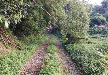
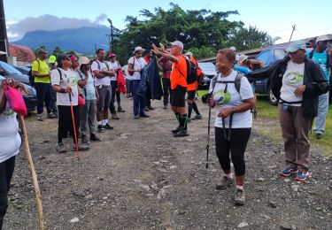
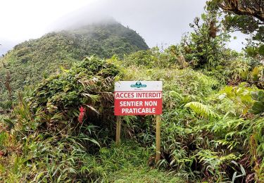
Trail On foot Le Lorrain - Le Lorrain - Fonds-St-Denis - Photo

Le Lorrain - Fonds-St-Denis

 Lamartiniere
Lamartiniere

User GUIDE

© OpenStreetMap contributors
Length
Length
16.7 km
Max alt
Max alt
619 m
Uphill gradient
Uphill gradient
774 m
Km-Effort
Km-Effort  
26 km
Min alt
Min alt
156 m
Downhill gradient
Downhill gradient
595 m
Boucle
Boucle
No
Creation date :
2023-04-26 20:14:06.851
Updated on :
2023-04-26 22:44:07.279

(0 Reviews)

On foot
On foot
5h59
Difficulty : Medium

Scan this QR Code to open this trail in the SityTrail application

FREE GPS app for hiking

Logo SityTrail SityTrail

IGN / Geographical institutes

Download SityTrail from the App Store Download SityTrail from Google Play

Logo SityTrail SityTrail World

The world is yours!

Download SityTrail from the App Store Download SityTrail from Google Play Download SityTrail on Huawei AppGallery

About

Trail On foot of 16.7 km to be discovered at Martinique, Unknown, Le Lorrain. This trail is proposed by Lamartiniere.

Description

Cette randonnée nécessite demande d'autorisation de passage obligatoire pour groupe Soleil.
Test pour le" Défi Ti Chimen" (Groupe Soleil)
Plateau Morne Capot, le Lorrain - Place Jules Pain, Fonds-St-Denis via le Bois Jourdan, environ 17 kms Descente vers Ecole maternelle et Eglise) arrivée Place Jules Pain.

Départ  Groupe Etoile  :   Devant  Socomor,  direction  Etablissement Source minérale Champflore,  Centre des sourds et muets,   Fonds-St-Denis, via Col Yang Ting,  passage près  école Maternelle puis église et arrivée  Place Jules Pain.  

Elevation profile

Positioning

Country:
France
Region :
Martinique
Department/Province :
Unknown
Municipality :
Le Lorrain
Location:
Unknown
Start:(UTM)
704753 ; 1639396 (20P) N.

Trails nearby

Trail Walking Le Morne-Rouge - Mac Intoch - Morne Capot - Photo
Walking
GUIDE
Lamartiniere

Walking

Medium
(1)
Le Morne-Rouge, Martinique, Unknown, France
9.4 km | 14.9 km-effort
4h 53min
No
Trail Walking Le Lorrain - Boucle Morne Capot via La Pirogue - Photo
Walking
GUIDE
Lamartiniere

Walking

Medium
Le Lorrain, Martinique, Unknown, France
10.3 km | 14.4 km-effort
3h 30min
Yes
Trail Walking L'Ajoupa-Bouillon - Cascade Dany  - Photo
Walking
GUIDE
Jean-Luc Farant

Walking

Easy
L'Ajoupa-Bouillon, Martinique, Unknown, France
3.8 km | 5.3 km-effort
1h 12min
No
Trail Walking Le Lorrain - La Crabière-Tapis Vert - Photo
Walking
GUIDE
Jean-Luc Farant

Walking

Medium
Le Lorrain, Martinique, Unknown, France
7.9 km | 10.3 km-effort
2h 20min
No
Trail Walking Basse-Pointe - Exploitations agricoles en boucle N°1 - Photo
Walking
GUIDE
Lamartiniere

Walking

Medium
Basse-Pointe, Martinique, Unknown, France
13.2 km | 16.5 km-effort
4h 0min
Yes
Trail Walking Le Lorrain - Mornes Capot / Lorrain Martinique - Photo
Walking
GUIDE
GabyG

Walking

Medium
(1)
Le Lorrain, Martinique, Unknown, France
8.5 km | 11.8 km-effort
3h 41min
Yes
Trail Walking Basse-Pointe - Boucle de chalvet, Pécoule vers Chalvet. - Photo
Walking
GUIDE
GabyG

Walking

Medium
Basse-Pointe, Martinique, Unknown, France
6.5 km | 7.8 km-effort
3h 2min
Yes
Trail Walking Le Lorrain - Morne Jacob au Panneau ONF - Photo
Walking
GUIDE
Lamartiniere

Walking

Medium
Le Lorrain, Martinique, Unknown, France
4.3 km | 8.7 km-effort
2h 0min
No
Trail Walking Le Lorrain - trace des Amérindiens - Photo
Walking
GUIDE
GabyG

Walking

Medium
Le Lorrain, Martinique, Unknown, France
5.1 km | 6.6 km-effort
2h 40min
No


Close
My subscriptions